Environment Supporting ecosystems using satellite images Forests are essential in maintaining healthy ecosystem interaction and biodiversity on Earth. They are in a key role in the fight against climate change since they can restore increasing carbon
Climate change Climate change mitigation using satellites Forest biomass and carbon monitoring play a key role in climate change mitigation. Operational large area monitoring approaches are needed to enable forestry stakeholders to meet the increasing monitoring and
Recruitment We're hiring - GIS Project Manager We are looking for a full-time Project Manager with know-how in some of the following fields: * Project management * Satellite data analysis * Geoprocessing * Python, GDAL, PostGIS, Machine learning If you are
News Terramonitor Web Store Press release, May 28 2020 Terramonitor launches a Web Store that provides easy access to analysis-ready satellite images and up-to-date satellite maps. By processing thousands of satellite images per day
Forestry VESA Index technology Terramonitor has developed a machine learning based mapping service, which locates harmful shrubs in boreal forests. The service provides valuable information for forest professionals about growth states of forests. The
Machine Learning Raster Matrix Algebra part 1 In geoinformatics, a raster image is a dot matrix data structure that represents a (generally) rectangular grid of pixels. Most satellite images are stored into a raster file format at
AI Satellite mosaic validation by Terramonitor Labs Let's say you have a Sentinel-2 satellite image mosaic over a large area, for example Russia. The image is supposed to represent the surface reflectance of the area. How do
Earth observation Introducing the Sentinel-2 Mosaic Service How can I get multi-band satellite data for my area of interest? Terramonitor's Sentinel-2 Mosaic Service provides automated satellite image preprocessing and delivery, enabling GIS people to focus on what
Forestry Errors related to the automatized satellite-based change detection of boreal forests in Finland Terramonitor took part in a Finnish government head project related to detecting changes in boreal forests during 2016-2019. Time series change detection.The project was executed by Teknologian tutkimuskeskus VTT
Earth observation If algorithms could talk, part 1 Currently thousands of earth observation satellites are sending data to the surface around the clock. My goal is to make the most out of that data. This story is about
Earth observation NDVI(BOA) vs. NDVI(TOA) The normalized vegetation index (NDVI) is a remote sensing measure that describes the difference between visible and near-infrared reflectance and can be used to estimate the density of green vegetation
Recruitment We're hiring - Space Sales Manager We’re looking a sales and marketing developer to scale our business
Webinar Introduction to Terramonitor 
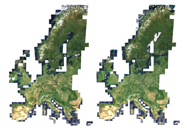
At the end of June 2018, Terramonitor released the world's most up-to-date cloudless satellite map of the globe. Today the service is used by hundreds of users around the world
Story Our Story Terramonitor's mission is to make space data reachable for anyone, anywhere and anytime.