Terramonitor Web Store

Press release, May 28 2020
Terramonitor launches a Web Store that provides easy access to analysis-ready satellite images and up-to-date satellite maps. By processing thousands of satellite images per day with AI and cloud computing, Terramonitor provides revolutionary tools for monitoring and analyzing the globe from space.
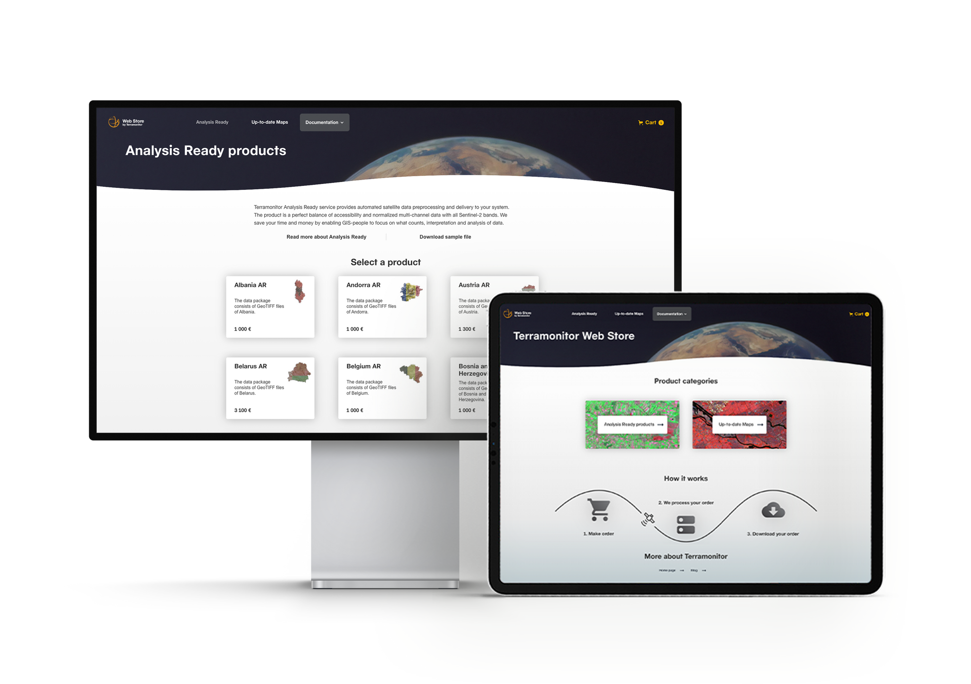
Terramonitor, a leader in space data solutions, has today announced opening a Web Store (store.terramonitor.com), which offers Analysis Ready satellite image mosaics and Up-to-date Maps. The catalog contains off-the-shelf products from all European countries and an option for user-defined areas of interest from anywhere in the world.
Analysis Ready is a cloudless mosaic generated by automated satellite data preprocessing. The product is ready to use for different purposes, for example, analyzing land cover, vegetation, forestry, agriculture, carbon sinks and spectral indices. AI-powered preprocessing combines satellite images and excludes unusable image parts to create a uniform mosaic of corrected and normalized 10-band multispectral data. The Analysis Ready product enables GIS professionals to focus on what counts, without having to manually search and calibrate cloud-free images for full coverage of the area of interest.
Up-to-date Maps solves the problem when traditional and often outdated geographical information is not enough. The product consists of continuously updating satellite map layers hosted 24/7 by Terramonitor. It is the best possible collection of available data providing up-to-date and high resolution views of the earth. Up-to-date Maps is designed for all users requiring easy-access remote sensing imagery.
Dr. Lauri Häme, CTO of Terramonitor, describes the products as a result of persistent development: “We have tried, tested, and seen the pain points in our daily work. With each iteration, our process has become faster, more robust, and able to handle even larger amounts of data. The mosaicing, cloud detection and calibration algorithms have been developed and fine-tuned to make the most out of industrial-grade servers in the cloud.” He sees the Terramonitor Web Store as a response to a global megatrend: “The popularity of e-commerce is growing at an unprecedented rate. People are buying almost everything online, from clothes and groceries to books and electronics. Now we are bringing Space Data to the table.”
Terramonitor’s technology is based on cutting edge machine learning methods and the latest cloud solutions. Cost-effectiveness of the products is ensured by automated processing based on artificial intelligence. The new Web Store enables GIS people to access these off-the-shelf satellite data products with a couple of clicks. Space Data has never been easier.
For more information, visit store.terramonitor.com or email lauri.hame@terramonitor.com.
About Terramonitor
Terramonitor is a Space Data company. We have developed a global satellite-based data platform that covers more than 100 million satellite images. Our technology is based on efficient and automated data processing chains and the utilization of artificial intelligence. Our mission is to make Space Data easy and simple to use and to help our customers make better decisions.