Terramonitor Feed
  • < Back to terramonitor.com
  • Space Data
  • Research
  • Cooperation
Sign in Subscribe

Land Cover

A collection of 3 posts
Optimal land cover sampling
Land Cover

Optimal land cover sampling

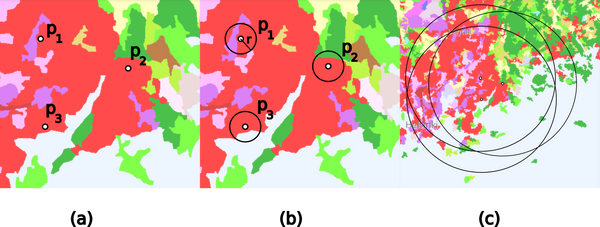
Land cover is defined as the physical material at the surface of Earth. Different types of land cover classes include for example grass, asphalt, trees, bare ground and water. Information on land cover is usually captured using field surveys and analysis of remotely sensed imagery. Land cover sampling is a
Oct 15, 2023 3 min read
Satellite images and type 1 diabetes
Research

Satellite images and type 1 diabetes

Type 1 diabetes is a chronic autoimmune disease that affects millions of people around the world. It occurs when the body's immune system mistakenly attacks and destroys the insulin-producing cells in the pancreas, resulting in a lack of insulin production and regulation of blood sugar levels. One possible
Sep 19, 2023 2 min read
The Fastest Way to Extract Values from Geospatial Data
GIS

The Fastest Way to Extract Values from Geospatial Data

A considerable part of what we do at Terramonitor can be summed up by the extract, transform, load (ETL) paradigm. This happens both in internal processes and in those that are externally triggered. And sometimes those processes are too slow.
Nov 12, 2020 3 min read
Page 1 of 1
Terramonitor Feed © 2025
Powered by Ghost