How good are the satellite images compared to aerial images?

Satellite images have become an everyday part of modern life, allowing us to view our life from a bird eye perspective. But what can be actually seen from these images?
Optical satellite images are captured by orbiting satellites that use various bands to detect and radiation emitted or reflected by the Earth's surface. These satellite sensors can capture data in various wavelengths which are then used to create images and maps of the Earth's surface. But how good are the satellite images? That is the question we get often and there is no simple answer.
The ability to monitor large areas of the Earth's surface on a regular basis has been instrumental in tracking changes over time, such as deforestation, urbanization, and climate change. We think that the strengths of the satellite data are the ability to have a higher revisit frequency, large areas of imaging and comparable data quality.
The resolution of the images is dependent on the quality of the sensors on the satellite, and the altitude of the orbit. Traditionally, satellite image resolutions are categorized into four categories: low, medium, high resolution, and very high resolution.
Low and medium-resolution satellite images have a pixel size from 10 meters to kilometres, and are used for monitoring large-scale environmental changes. This data is usually openly available, with low cost and comes with daily to weekly revisit time. So there is a lot of data available. These satellites offer also bands that human-eye can not see and data quality itself is pretty stable and repeatable. But for visual recognition the resolution is often too scarce to identify details with human vision. For this reason, you don’t see these images so much in the media but it is used for many research and environmental purposes.
High-resolution satellite images have a pixel size between 1 to 10 meters and provide detailed information about individual buildings size features on the ground. There are a lot of different satellites and sources to acquire the data, up to daily revisit times. On the upper end of the resolution with 10m you can expect to recognize things like loggings, fields and residential areas but zooming in to recognize objects you usually need resolution from the lower end. Upper
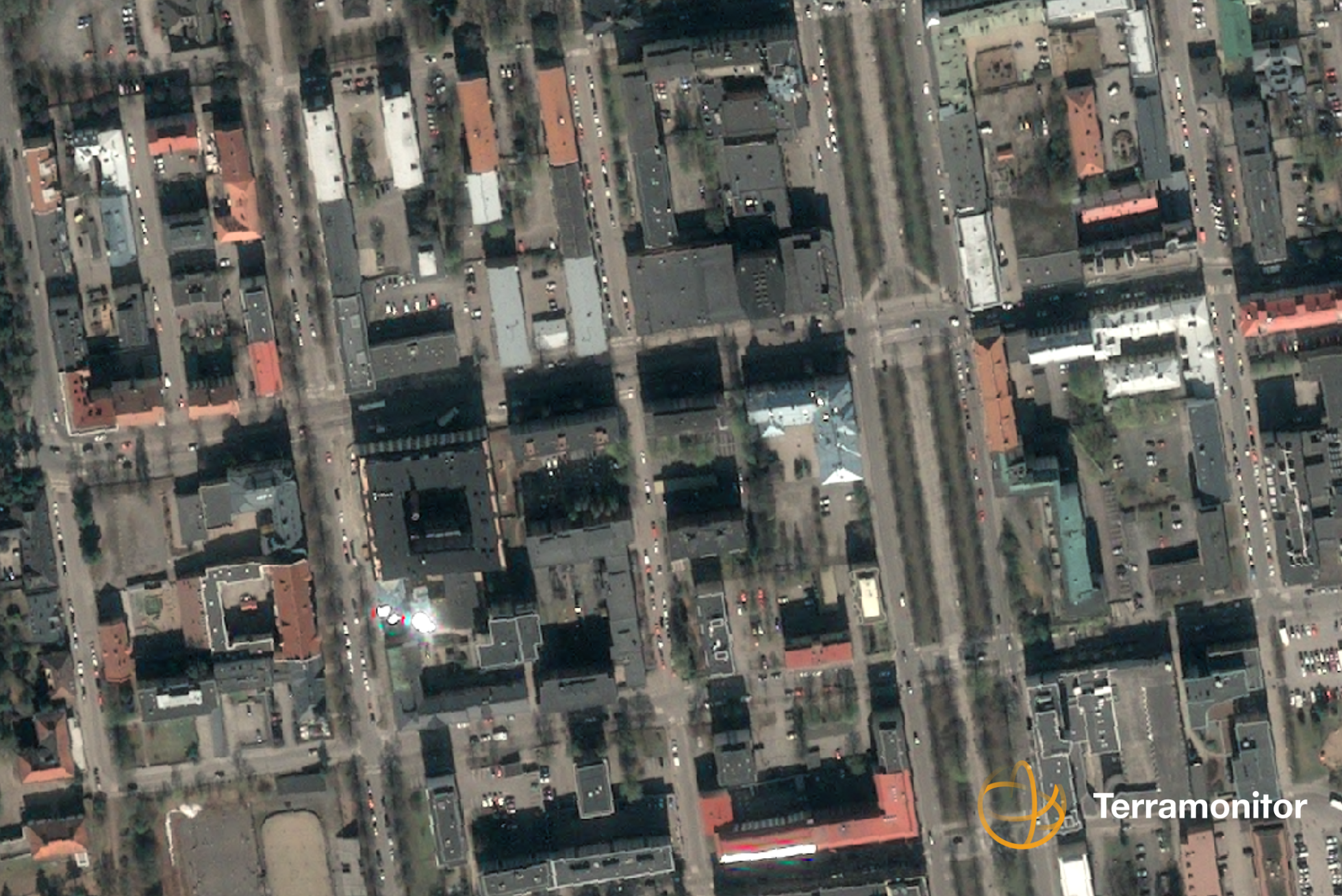
Very high-resolution satellite images have a pixel size of less than 1 meter, down to 30 cm per pixel, and are capable of capturing individual trees, vehicles or other relatively small objects.
It is important to note that higher-resolution images generally come with higher costs and require more storage and processing capabilities. The choice of resolution depends on the purpose of the image and the resources available to acquire and process it. But in our opinion satellite images can replace the use of orto aerial images in many cases. When comparing costs between aerial images and satellite images, the costs are usually a bit less with the satellites especially when not imaging thousands of square kilometers at once.
Overall, satellite images are a time-efficient and flexible choice when compared to other remote sensing methods done with airplanes, helicopters or drones and the quality of the data is usually very similar. If you have any questions or you want to know more, please contact us via https://www.terramonitor.com/contact