VESA-index 2022 published Terramonitor has been publishing VESA-index for Finnish conifer stands for six years in a row since 2017. VESA stands for Vegetation Enhanced Status Analysis. The VESA-index is used to interpret
Cooperation ENABLING THE USE OF SPACE DATA FOR MEDICAL RESEARCH HEDIMED aims to identify the disease mechanisms and environmental factors of type 1 diabetes, celiac disease, asthma and allergies. HEDIMED is a large EU-funded 12M€ research project that started in
Earth observation When Space Data makes a difference How did we help to change how Finnish Forest Act is monitored? When we started working with Space Data, one of our first major projects was a project by the
Carbon Forest Carbon Monitoring project moving to implementation phase Forest Carbon Monitoring (FCM) is a project led by VTT and financed by the European Space Agency ESA, aiming to create a new forest carbon service for forest operators’ needs.
Environment Supporting ecosystems using satellite images Forests are essential in maintaining healthy ecosystem interaction and biodiversity on Earth. They are in a key role in the fight against climate change since they can restore increasing carbon
Climate change Climate change mitigation using satellites Forest biomass and carbon monitoring play a key role in climate change mitigation. Operational large area monitoring approaches are needed to enable forestry stakeholders to meet the increasing monitoring and
Recruitment We're hiring - GIS Project Manager We are looking for a full-time Project Manager with know-how in some of the following fields: * Project management * Satellite data analysis * Geoprocessing * Python, GDAL, PostGIS, Machine learning If you are
Smart cities How GIS Tech is Paving the Way for Smart Cities of the Future 
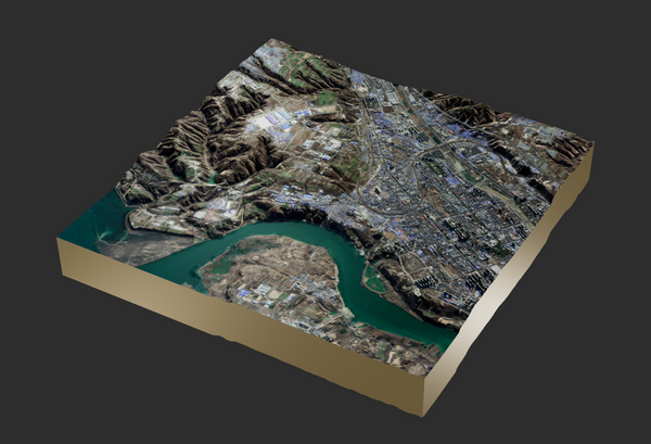
The smart city: Though it sounds like a futuristic dream, you may have already unknowingly visited one. Currently, Singapore is the world's gold standard for smart cities, and following close
Cooperation Headpower and Terramonitor implement one million EUR development project with ESA and electricity distribution companies Press release - Helsinki, Finland - 18th June 2021 The vegetation and risk management system based on satellite data developed by Headpower and Terramonitor is progressing to Pan-European piloting. In
Cooperation Headpower ja Terramonitor toteuttavat ESA:n ja sähköverkkoyhtiöiden miljoonan euron pilottihankkeen Headpowerin ja Terramonitorin kehittämä satelliittidataan perustuva kasvillisuuden ja riskien hallintajärjestelmä etenee Euroopan laajuiseen pilotointiin. Euroopan avaruusjärjestö ESA:n tuella toteutettava hanke tähtää sähköverkon toimintavarmuuden parantamiseen. Mukana hankkeessa ovat ESA:n
Cooperation Terramonitor joins Forest Carbon Monitoring project with F-TEP Continuing the presentations of projects utilizing Forestry TEP, we are excited to tell you about the new Forest Carbon Monitoring (FCM) project to be launched in July. Terramonitor (Satellio) Lab's
Space Data Satellite images, to see or not to see Usually talking about earth observation we talk about optical satellite images similar to our family photos. On top of these optical images, satellite data can be produced with other bands
GIS The Fastest Way to Extract Values from Geospatial Data A considerable part of what we do at Terramonitor can be summed up by the extract, transform, load (ETL) paradigm. This happens both in internal processes and in those that are externally triggered. And sometimes those processes are too slow.
Cooperation Zero Gravity and Terramonitor to gain ESA contract for Green Buildings HELSINKI, Finland. 3rd November 2020 Zero Gravity Oy and Terramonitor aligned a consortium for ESA (European Space Agency) open bidding for Green buildings - Feasibility Study during spring 2020. Green
GIS Normalizing and classifying raster data using gdal_translate and gdal_calc No satellite-borne instrument can fully deal with external artifacts and interference. Let's take a look at how gdal_translate and gdal_calc.py can be used to normalize and classify noisy real world data.
Recruitment We're hiring - GIS Project Manager We are looking for a full-time Project Manager with know-how in some of the following fields: * Project management * Satellite data analysis * Geoprocessing * Python, GDAL, PostGIS, Machine learning If you are
Earth observation Terramonitor Analysis Ready - 4 examples of use cases Terramonitor Analysis Ready product is a cloudless mosaic of preprocessed satellite data with 10-band multi-spectral data. The images used for mosaic are atmospherically corrected and radiometrically calibrated. The product is
Cooperation Monitoring Atmosphere Satellite data provides an opportunity to monitor the atmosphere. One satellite suitable for monitoring is Copernicus Sentinel-5P. This satellite enables atmospheric measurements and to map gases such as nitrogen dioxide,
News Terramonitor Web Store Press release, May 28 2020 Terramonitor launches a Web Store that provides easy access to analysis-ready satellite images and up-to-date satellite maps. By processing thousands of satellite images per day
Cooperation New partnership agreement between Wuudis and Terramonitor Terramonitor maps and data now available in Wuudis to identify precise information on urgent care works and seedling thinning sites.
Forestry VESA Index technology Terramonitor has developed a machine learning based mapping service, which locates harmful shrubs in boreal forests. The service provides valuable information for forest professionals about growth states of forests. The
Machine Learning Raster Matrix Algebra part 1 In geoinformatics, a raster image is a dot matrix data structure that represents a (generally) rectangular grid of pixels. Most satellite images are stored into a raster file format at
AI Satellite mosaic validation by Terramonitor Labs Let's say you have a Sentinel-2 satellite image mosaic over a large area, for example Russia. The image is supposed to represent the surface reflectance of the area. How do
Cooperation HEDIMED - PROJECT HOW CAN SPACE DATA HELP MEDICAL RESEARCH? We joined a Hedimed- consortium in early 2019 to take part in EU Horizon 2020 -application process. The project got thru the evaluation
GIS PostGIS and why we like it A short introduction of PostGIS and why we chose it for storing our vector data. A case study of ST_Simplify.