Finnish Space Data Company Terramonitor Released a Finland-Wide VESA Index for Shrub Detection
Terramonitor, a space economy forerunner, released VESA Index, the most extensive artificial intelligence shrub detection service in Finland.

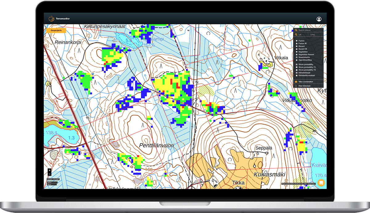
Terramonitor released an AI-based shrub mapping service for forest professionals
PRESS RELEASE
HELSINKI 17.4.2019
Terramonitor, a space economy forerunner, released VESA Index, the most extensive artificial intelligence shrub detection service in Finland. The goal of VESA Index is to analyze harmful shrub levels of Finland’s forests and locate forest seedlings which require care. A summary report of VESA Index is available as a free download at www.vesaindex.com.
Terramontor has developed VESA Index specifically for professionals in the forest sector. The unique AI technology enables the detection of harmful shrub rate of seedlings quickly and cost-effectively. The service benefits forest owners, forest maintenance professionals and other stakeholders in the forest industry.
The founder and CEO of Terramonitor Joni Norppa describes the value of VESA Index: “Sustainable forest management starts with assessing the current situation. Today, Finland's forests’ harmful shrub rate is increasing rapidly, which causes financial, operational and socio-economic challenges. In terms of monetary value, there are hundreds of millions of euros worth of work lying in forests. The value of VESA Index comes from a better understanding of shrub situation and planning the correct actions accordingly.”
In addition to regional analyses, VESA Index is available in a package covering the whole of Finland. To support the interactive mapping service, VESA Index analysis is offered in spreadsheets as well as in professional formats.
More information about VESA Index: www.vesaindex.com.
Inquires
Joni Norppa, CEO
+358 50 360 8096
joni.norppa@terramonitor.com
About Terramonitor
Terramontor develops the world’s most up-to-date AI-based satellite service. Terramonitor service processes over 100 million satellite images of the world. The service allows professionals to build, organize and analyze geographical information.